Microwave Path Surveys & Design
 TCS Consultants, Inc. is a leader in microwave path surveys and design. Using custom
designed cloud based software to import to and export from Pathloss 5.0
(and the older Pathloss 4.0 if desired), TCS eliminates the possibilities of typos from
repetitive report insertions. This custom software also allows for real-time point
elevation
validation, FCC and FAA data comparison, location data integration, on-the-fly
topographical
map insertion with markers & labels, and many other significant report enhancement. And
while
the accuracy and precision are the main objective, the software automation cuts report
creation
time by 75%.
TCS Consultants, Inc. has been performing microwave path surveys since before laser
range-finders and GPS existed. While these tools have made the job much easier, the
knowledge of
performing these services without these technologies has proven invaluable at times or
locations
where these products fail (lasers do not work in heavy mist / fog / mountain-top
clouds) and
GPS units are subject to multi-path interference. It should also be noted that the
accuracy of
laser ranging units vary significantly. When your paying for a services that is critical
to your reputation, we don't believe 'counting joints' and guessing at location and
antenna sizes cuts it. While checking tree heights may not be
problematic,
performing tower elevation audits can be costly if the errors exceed a couple of
feet.
TCS is unique in having created some of the first available commercial software for
designing
microwave systems and unique in that it also provided full services tower crews to both
install
and maintain these systems. TCS has also helped some of the leading technical engineers
create
and implement new microwave design standards.
While TCS no longer provides commercially available software or installation crews, the
education and experience of those services provided an unprecedented knowledge that
could be
gained from no other source. TCS has been designing microwave systems since before
inception in 1984.
Microwave Path Survey & Design Process
- Acquire coordinates and proposed design.
- Create preliminary profiles
- NED 1/3-ARC TERRAIN DATA
- Satellite site validation
- Cross check site data with FCC ASR (if applicable)
- Coordinate site access and availability
- Research tree heights for the general area for preliminary antenna heights
- Determine preliminary antenna sizes based on proposed equipment
- Note preliminary information to customer.
- Perform physical path and site survey
- Site Information
- Acquire accurate latitude and longitude of site using DGPS
- Measure tower data using surveyors transit & laser measuring devices
- Acquire digital photographs
- General Site Pictures
- Waveguide Entry Ports
- Existing Waveguide Mounting
- Posted Site Data / Signage
- Overall Structure Pictures
- Tower Appurtenances
- Near Field Site / Path Pictures
- Determine Near Field Obstructions
- Any pertinent data that would affect installation
- Road Type / Condition
- Access Type
- Limitations
- Size of Communications Building
- Distance from Building to Antenna Structure
- Path Information
- Acquire digital pictures of azimuth (if not obstructed)
- Traverse path using GPS receiver and integrated maps
- Note pertinent obstruction and terrain data
- Measure obstructions using transit or laser clinometer
- Acquire digital pictures of pertinent obstructions
- Site Information
- Microwave Path Design
- Acquire desired path design criteria from customer
- Create path profile from measured data
- Determine antenna heights on structures
- Determine reflection points and phase antennas
- Adjust ACLs based on structure appurtenances
- Compile Customer Report
- General Report
- Elevation grid map of system
- Hwy map and atlas of the system
- General scope of work
- Path antenna heights, tx lines, and frequency summary
- Site DGPS coordinates, tower heights, and ASR summary
- Path Equipment hardware and radio summary
- Method of survey
- Path design criteria
- Path and site data overview
- Conclusions and contact information
- Glossary of terms and acronyms
- Site Data
- Google Geomap w/ markers
- Topographica Map w/ markers
- Site description
- Geodetic Coordinates, elevation, method
- FCC ASR data
- FAA TowAIR data
- Access Information
- Equipment shelter information
- Antenna structure information
- Proposed antenna information
- Structural elevation drawing
- Birdseye drawing (if applicable)
- Area plat of communcations compound (if applicable)
- Inside building drawings for existing & proposed equipment (if applicable)
- Site photographs
- Path Data
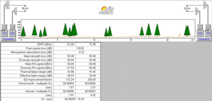
- Path profile
- Detailed terrain data information
- Path calculations and reliability worksheets
- Antenna clearance report
- Antenna orientation report
- Path reflection phase calculations
- General Report
- Create soft-copy report
- Provide download URL for customer to include:
- Microwave path survey report
- Reduced size report - Adobe compressed
- PDF path data sheets (also included in report)
- CSV pathloss file for quick spreadsheet use
- Pathloss 5.0 (or 4.0) files
- Tower elevation drawings (also included in report)
- Send Invoice
Note: There are no additional costs associated with report revisions, equipment mods, or design alterations that don't require additional trips to the field (new sites, reroutes, or sites moving considerable distances). This is a significant cost savings when the physical path survey alters the original assumptions of the customer's preliminary design (which is almost always the case).